The Upper Valley and the East Side of El Paso sit on radically different subsurface profiles, even though they share the same Chihuahuan Desert climate. In the Upper Valley, near the Rio Grande's historic floodplain, you often hit silty clay with organics within the first four feet; ten miles east, toward the Hueco Bolson, the same depth reveals clean, wind-blown sand over cemented caliche layers. That contrast is exactly why we run exploratory test pits early in the investigation. A backhoe trench opened to 10 or 12 feet tells us more about depositional history in one afternoon than a dozen split-spoon blows alone. We pair the visual log with grain-size data to confirm the USCS classification and with atterberg-limits when the fine fraction exceeds 12%—critical for predicting shrink-swell behavior in El Paso's clay-rich basin fill.
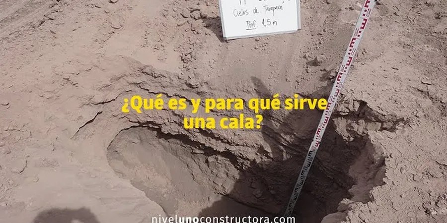
A 12-foot test pit on the El Paso basin floor reveals more about depositional energy and paleo-channel geometry than any indirect method.
Methodology and scope
Local considerations
El Paso gets barely 9 inches of rain a year, but when a monsoonal cell stalls over the Franklin Mountains, the arroyos can carry a wall of water in minutes. Test pits excavated in July can look dry and competent at the base, yet the same soil mass in September—after a single convective storm—may show perched water at the contact between the silty overbank deposits and the underlying caliche. That seasonal shift fools shallow foundation design if you only read a log from the dry season. We time our exploratory test pits carefully: for critical structures, we recommend one dry-season excavation plus a follow-up observation window after the first significant runoff event. In the low-lying Mission Valley, where historic irrigation has raised the groundwater, we routinely measure seepage rate inside the pit and correlate it with in-situ-permeability tests to give the structural engineer a realistic long-term buoyancy scenario.
Applicable standards
ASTM D2488-17e1 (Visual-Manual Description of Soils), ASTM D422-63(2007) / D6913 (Particle-Size Analysis), OSHA 29 CFR 1926 Subpart P (Excavation Safety), IBC 2021 Chapter 18 (Soils and Foundations — test pit applicability), TxDOT Tex-142-E (Test Pit Logging Guidelines)
Associated technical services
Basin Fill Stratigraphic Logging
Detailed trench-wall mapping of the Fort Hancock and Camp Rice formations, including identification of buried caliche horizons, paleo-channel sands, and expansive clay seams. Each log includes Munsell color, pocket penetrometer values, and photo panels with scale.
Bulk Sampling for Laboratory Physical Properties
Collection of 40-60 lb disturbed samples per stratigraphic unit, transported in sealed buckets to our accredited lab for Proctor compaction, Atterberg limits, and particle-size analysis. We maintain chain of custody documentation suitable for City of El Paso building permit review.
Typical parameters
Frequently asked questions
How deep can you excavate a test pit in El Paso's caliche before refusal?
In the Stage III to IV caliche common across the eastern and central El Paso basin, a standard 4WD backhoe typically reaches refusal between 6 and 10 feet. When the petrocalcic horizon is massive—often in the Camp Rice Formation—the bucket will ride up and excavation stops. At that point we log the refusal depth, estimate the cemented material's compressive strength with a pocket penetrometer, and recommend supplementing with CPT soundings to profile the softer sediments that often underlie the hardpan.
What does an exploratory test pit cost in El Paso?
For a typical El Paso residential or light commercial site, an exploratory test pit program—including backhoe mobilization, excavation of two to three pits to 10–12 feet, OSHA-compliant sidewall protection, logging per ASTM D2488, and bulk sampling—falls between US$440 and US$890. The final figure depends on access conditions, caliche thickness, and whether the City requires a traffic control plan for pits located in the public right-of-way.
Do I need a separate permit from the City of El Paso to excavate test pits on my lot?
For private property, the geotechnical investigation itself does not typically require a standalone City permit, but you must call Texas 811 at least 48 hours before excavation to locate underground utilities. If the test pit is within the street right-of-way or a drainage easement, a right-of-way permit from the City of El Paso Development Services Department is required. We coordinate the utility locate and the permit application as part of the mobilization scope.